See the whole site.
Aerial photos and video to document a place, follow its progress, and show others what matters.
DRONE PHOTOGRAPHY & VIDEO / METRO VANCOUVER
Aerial photos and video to document a place, follow its progress, and show others what matters.
Explore what we captureAerial photos and video to document a place, follow its progress, and show others what matters.
Agree the views you need: the wider setting, access routes, or a closer look at visible surfaces.
A closer view means more when you can place it within the whole site.
Overview and detail become a set of images you can use and share.
Tell us what you need to see, where it is, and who will use the images.
WHAT WE CAPTURE
Choose the question first. We can then discuss the views, files, and visits that fit it.
A wide aerial still can show how a place is laid out: roofs, yards, access, and what sits next to it. That shared picture is often the first useful output.
When you need a closer look at a roof, elevation, or access yard, we can photograph what is visible from a safe position. The files support review; they do not diagnose a defect.
Repeat visits can use an agreed viewpoint list so a team can see what changed. Each visit still depends on access, weather, and the site as it actually is that day.
Stills and plain edited clips help owners, customers, and stakeholders understand a place without standing on it. Scope stays tied to the brief.
ILLUSTRATIVE EXAMPLES
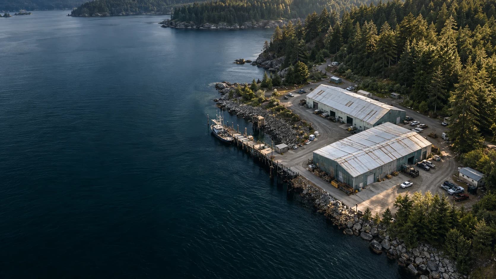
An overview can show buildings, access, and surroundings together. The coastal scene here is a concept image, not a client location.
Property and site overview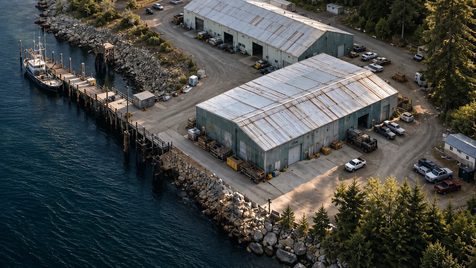
A tighter frame is for agreed surfaces and access. It is still a picture, not a diagnosis or survey.
Visible exterior conditions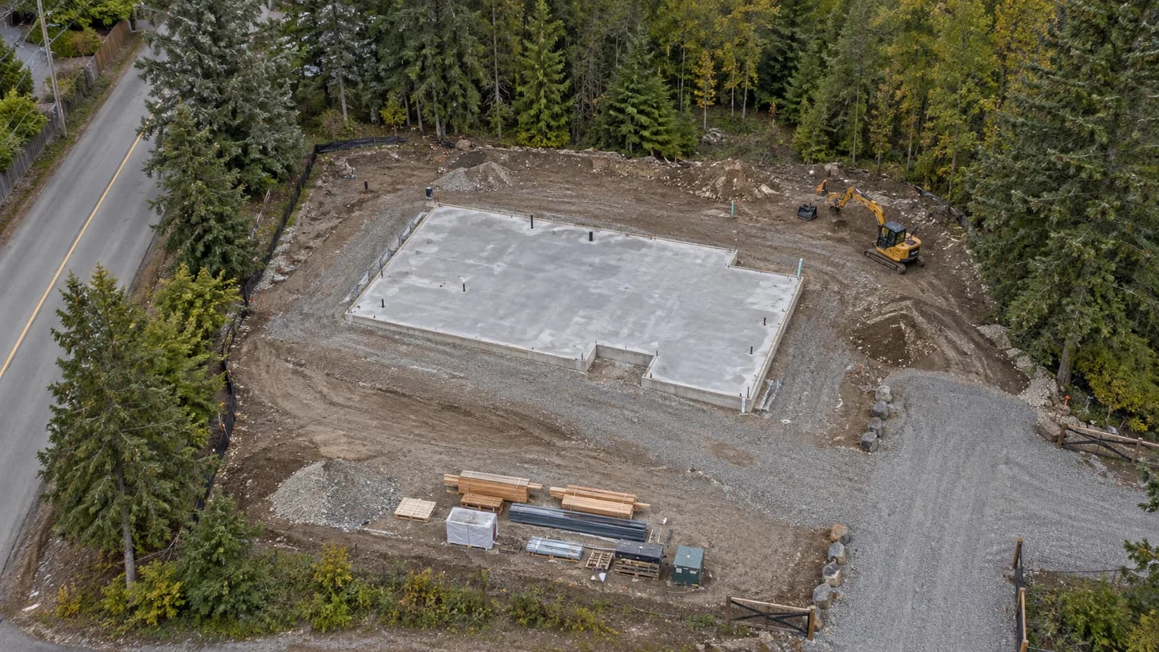
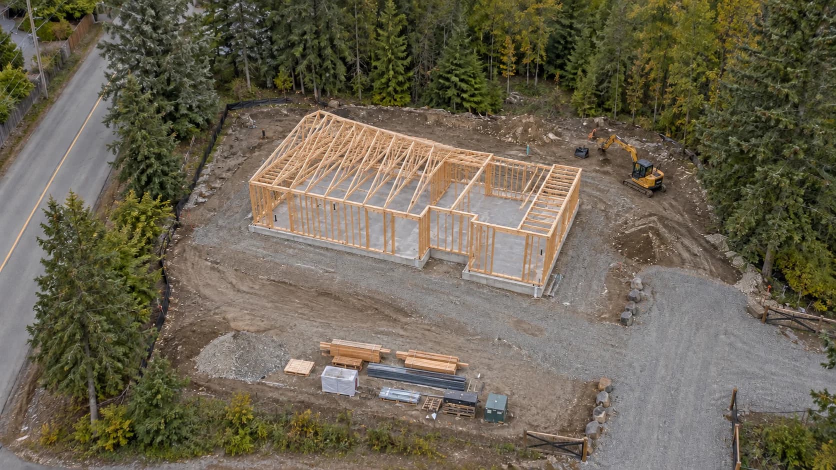
Example framing for comparing a site across planned visits.
Progress and repeat visits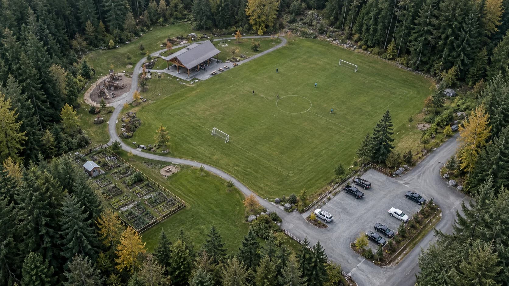
Stills and plain edited clips can help people who are not on site understand layout and setting.
Aerial photos and videoHOW IT WORKS
Tell us the purpose, location, timing, and who will use the files. A short shot list is more useful than a vague request to “fly the site.”
We look at access, weather windows, and whether the airspace and surroundings make the request feasible. Some requests cannot proceed.
On an agreed date, we photograph the views in the brief. The visit can be paused or moved if conditions are not suitable.
You receive the agreed file types for the agreed use. Anything beyond that scope needs a further written agreement.
ONE VISIT / REPEAT VISITS / A DIFFERENT USE
A property, a project, or a use we have not listed. Start with the place and what you need to understand.